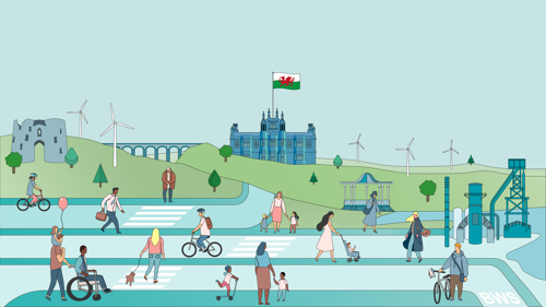
Active Travel
Active Travel Network Map: 2026 Update Statutory Consultation
Neath Port Talbot Council is updating its Active Travel Network Map (ATNM). This map sets out existing walking, wheeling, and cycling routes across the borough, alongside proposed improvements and future routes.
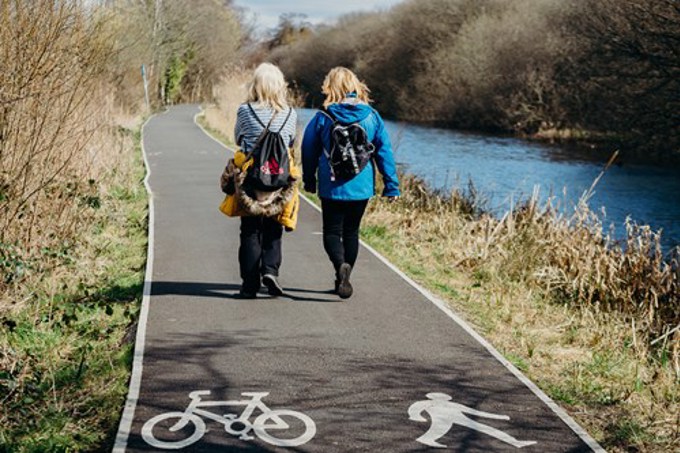
Active Travel is about making our everyday journeys - such as travelling to school, work or the shops by foot, cycling or wheeling.
Active Travel will save you money, improve your health and help the environment.
View NPT’s approved ATNM.
This plan sets out the vision for active travel and how the active travel network will be improved and extended in NPT over the next five years.
Changing the way we move around Neath Port Talbot will have a massive impact on your community. Did you know? 2 out of 3 journeys are less than five miles. If its not far, leave the car.
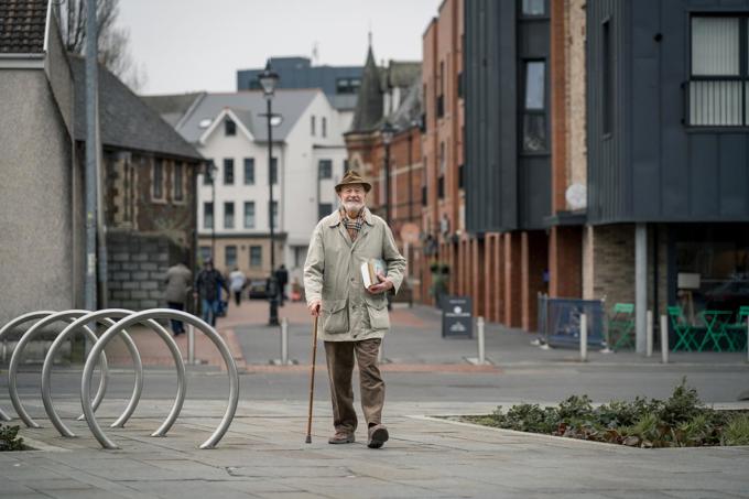
Need a bit of support to find your feet?
Useful tips to help you plan your journey.
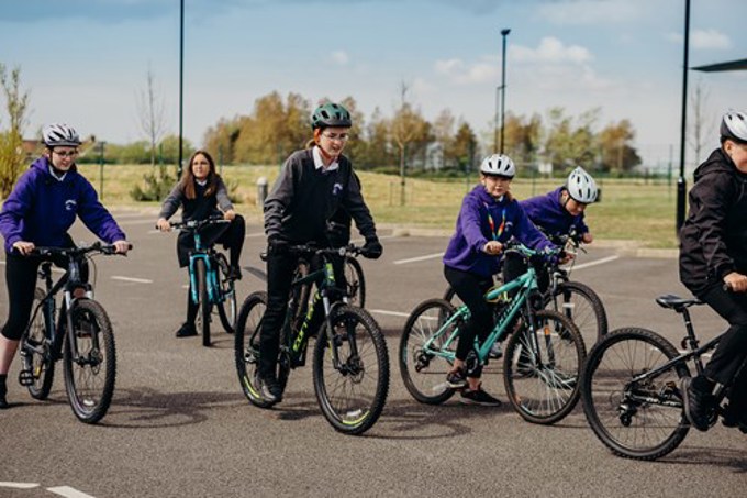
Surveys carried out as part of our active journeys programme in Wales show that pupils would prefer to travel actively if they were given the choice.
Employers across Neath Port Talbot should encourage employees to think walk, cycle or wheel.
We need your help as we shape Active Travel plans to improve towns and villages in Neath Port Talbot.
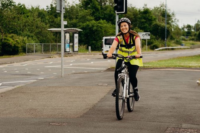
We are striving to make it safer and easier for people to walk, cycle and wheel in and around the county.
See the cycle storage and cycle barrier locations we have mapped out.
What is Active Travel?
Active Travel is about making our everyday journeys - such as travelling to school, work or the shops by foot, cycling or wheeling.


How will active travel help me?
You will save money
Cars can be expensive. Vehicle tax, maintenance, and insurance costs around £969 per year. And that doesn’t include the fuel to power it.
You will improve your health and wellbeing
Walking regularly can reduce the risk of heart disease and active travel helps to ease stress levels and benefit your mental wellbeing.
You will help your community and the planet
Active travel cuts congestion, carbon dioxide (CO2) emissions and other air pollutants.
You will save time
It’s quicker than you think – you can walk a mile in around 15 – 20 minutes or cycle it in five. It could take longer to find your car keys!


Active Travel Network Map
Our Active Travel Network Map shows where walking and cycling routes already exist (Existing Routes) and where upgrades or brand new routes are anticipated for the next 15 years (Future Routes).
As set out by Welsh Government these routes should be in the following areas:
Neath, Port Talbot, Pontardawe, Croeserw, Cymmer, Brynamman, Gwaun Cae Gurwen, Blaengwrach, Glynneath, Cwmafan, Seven Sisters and Resolven.
This is important because we are able to apply for funding from the Welsh Government each year to implement the proposals on the Active Travel Network map. If routes are not on the map they are not eligible for funding.
View the latest Active Travel Network Map approved in 2022:
Downloadable version of our Active Travel map
Active Travel Delivery Plan
The Neath Port Talbot Active Travel Delivery Plan sets out the blueprint for how we intend to encourage and facilitate a change in travel for local journeys by walking, cycling and wheeling (e.g. wheelchairs, scooters, prams). The Active Travel Delivery Plan recognises the economic and social value of active travel, articulating the role of different stakeholders and identifying priority actions that reflect resources.
Greener, Happier, Healthier
Up and down the country, more and more people are adopting active travel, to be:
- greener
- happier
- healthier
Changing the way we move around Neath Port Talbot will have a massive impact on your community. And you’ll discover new sights and sounds you’ve never come across!
Did you know? 2 out of 3 journeys are less than five miles.
Choose walking, cycling or wheeling


If it’s not far, leave the car!

Get inspired
Need a bit of support to find your feet?
Whether it’s taking things slow on a short walk or cycling to get around, being active can benefit us all.
Joining a local cycle club is a great way to get advice on cycling, the type of cycle to get to suit your purpose, plus it's a great way to enjoy the benefits of cycling, keeping fit and making new friends, below are some local cycle clubs you may wish to consider joining.
Swansea Wheelrights are a Swansea cycling club where the focus is to help get people on bikes by, eg, providing beginners' classes.
The Port Talbot Wheelers organise a variety of open races and time trials during the year. They have various rides throughout the week that suit varying standards.
The Swansea Cycle Group, cycle in the Swansea and outlying areas. All ages and levels are catered for but please note under 16 year olds must be accompanied by a parent or guardian.
Be prepared
- Lighten the load by keeping things at your destination when you can e.g. shoes or a second hairbrush.
- Small waterproof bags will keep your belongings safe from rain, sweat, or spillages without needing an expensive backpack.
- If you carry food, think about what might travel well and put it in an appropriate container.
- Lay everything out the night before for a morning trip. You will be less likely to forget something!
- Be active for as much or as little of your journey as you want to be. Getting off the bus a stop early and walking an extra 10 minutes counts.
- Team up with a friend or colleague to motivate each other and have some company.


Schools
Why schools should promote an active school run
Surveys carried out as part of our active journeys programme in Wales show that pupils would prefer to travel actively if they were given the choice.
It goes without saying the benefits of a more active travel policy for schools can be truly significant. These include:
- Children arrive at school fresh and ready to learn with increased concentration levels throughout the day
- The streets around the school are safer and the air cleaner, with less congestion.
- Encouraging an active lifestyle at an early age can help children later in their lives.
- Educating children about reducing carbon emissions and helping to protect our planet will help in our fight against climate change.
Employers
Free cycle stands
To help encourage more people to cycle, we are giving away up to four free cycle stands to organisations in locations where cycle parking is needed – workplaces, leisure facilities or amenities. Find out more details and apply.

Why employers should promote active travel with staff
Employers across Neath Port Talbot should encourage employees to think walk, cycle or wheel for a healthier and more environmentally friendly commute. Leaving the car at home is the greenest way to travel.
There are some great initiatives out there, such as the cycle to work scheme which is an employee benefit that saves 25-39% on a bike and accessories. Employees pay nothing upfront, and the payments are taken tax efficiently from their salary by you, their employer.
You could even hold competitions, asking employees to log their ‘active travel’ journeys to compete with colleagues to see who can clock up the most miles on foot/cycling.


How we can help
We would love to hear your ideas.
Please contact activetravel@npt.gov.uk for further information.
Active Travel Network Map: 2026 Update Statutory Consultation
Neath Port Talbot Council is updating its Active Travel Network Map (ATNM). This map sets out existing walking, wheeling, and cycling routes across the borough, alongside proposed improvements and future routes.
Have your say
We are inviting your feedback on the updated proposals.
You can take part by:
Consultation closes: 21st September 2026
Your feedback will help shape the final map before it is submitted to the Welsh Government for approval.
Recap of previous engagement
Last year, we asked for your views on how the network could be improved. We received 579 responses from residents, community groups, and stakeholders - thank you to everyone who took part.
Your feedback has played an important role in shaping the updated proposals.
How your feedback has been used
As a result of what you told us, the updated map now includes:
- 21 new future routes
- 11 modified routes
Key themes from your feedback
We also reviewed the wider issues raised in your responses. Several clear themes emerged:
- New routes (27%) - many respondents called for new connections, as well as the delivery of routes already identified.
- Accessibility (20%) - feedback highlighted barriers such as missing dropped kerbs, limited tactile paving, steep gradients, and physical obstructions. This reinforces the importance of creating routes that are accessible for everyone.
- Maintenance and environment (15%) - respondents emphasised the need to maintain existing routes, so they remain safe, usable, and attractive.
- Other themes - additional topics included paths and infrastructure, safety and crossings, lighting and visibility, parking and enforcement, amenities and facilities, connectivity and signage, and provision for equestrian users and bridleways.
These themes will help guide the Council’s wider active travel programme, alongside targeted improvements on the ground.
Read the full engagement report.
View the full list of changes.
View the proposals
You can explore the updated ATNM and supporting information using the links below:
- download PDF maps
- view the interactive map
- view prioritised future routes
Complete the survey
Paper copies of the survey are available at Neath Library and Port Talbot Library and will also be provided at public drop-in events.
Public drop-in events
If you would like to learn more or speak to the project team, a number of public drop-in events will be held across Neath Port Talbot during the consultation period:
| Event | Location | Date | Time |
|---|---|---|---|
| “Keeping you Safe” with Community Safety | Resolven Building Blocks | Tuesday 28th July | 12.00pm – 2.00pm |
| “Keeping you Safe” with Community Safety | Gwaun Cae Gurwen Community Centre | Friday 7th August | 11.00am – 1.00pm |
| Cohesion Cup | Port Talbot Cricket Club | Sunday 9th August | 9.30am – 2.30pm |
Further events to be announced - keep an eye on this webpage!
Frequently Asked Questions
What is the ATNM?
The Active Travel Network Map (ATNM) is a planning tool that shows the existing and future walking, wheeling and cycling routes in an area. It helps identify where improvements are needed to make it easier, safer and more convenient for people to travel actively for everyday journeys, such as getting to work, school or local services.
It is a statutory requirement for local authorities to produce and keep an ATNM under the Active Travel (Wales) Act, ensuring that active travel is properly planned and prioritised.
What is a ‘Future Route’ and how can I see what the design of the route will be?
Future Routes show where improvements to walking, wheeling and cycling are planned for the future. At this stage, they are just lines on a map showing the general location of the route - there are no detailed designs yet.
Improvements could range from larger changes such as new cycle tracks, to smaller improvements such as better crossings, or safer on-road cycling.
These routes are part of a long-term plan rather than confirmed projects. As each route is taken forward, designs will be developed in stages, with opportunities for the public to see design proposals and give feedback.
What is an ‘Existing Route’?
An Existing Route is a walking, wheeling or cycling route that is already in place and currently available for people to use. These routes form part of the existing active travel network and can include footways, shared paths, cycle tracks and quieter streets.
To be included on the Existing Routes layer of the Active Travel Network Map, a route must be assessed through an audit process and achieve a sufficient score against Welsh Government standards. Where a route does not meet the required standard, improvements may be identified to help bring it up to the necessary level.
Who is the network of routes for?
The network is for everyone, including:
- wheelchair and mobility aid users
- people walking or running
- cyclists of all abilities
- children, families and older people
A key priority is to ensure routes are inclusive and accessible, so more people feel confident choosing active travel.
Why is the Council updating and consulting on the map?
Through the Active Travel (Wales) Act 2013, the council is responsible for producing, maintaining and updating Active Travel Network Maps across the borough. The maps are important because we are able to apply for funding from the Welsh Government each year to implement the proposals on the Active Travel Network map. If routes are not on the map, they are not eligible for funding.
We are asking for your views to ensure the network:
- reflects how people actually travel
- identifies where routes feel unsafe or inaccessible
- creates better connections between communities and key destinations
Your feedback helps make sure the network is inclusive, usable and relevant to local people, not just based on technical assessments.
Why hasn’t my suggestion from the previous engagement been included in the updated ATNM?
Unfortunately, not every suggestion could be included in the updated ATNM. All suggested routes were carefully reviewed, taking into account how practical they are to deliver and whether they are likely to secure funding. In some cases, routes could not be included because of physical constraints or because they did not meet funding criteria.
Some routes that were suggested for removal have been kept. This is because they are important links in the wider network, helping to connect key places and make it easier for people to travel around Neath Port Talbot.
Should I respond again if I already took part last year?
We carefully reviewed all feedback from last year’s engagement, so please be assured that your comments have been recorded and you do not need to submit another response if you have nothing further to add. However, if you have any new comments on the updated map, we would very much welcome your feedback.
How is the ATNM and active travel funded?
The delivery of the ATNM from planning to delivery is typically funded through the Welsh Government’s Active Travel Fund. It’s a dedicated pot of funding, which means it’s been specifically set aside for these types of projects and can’t be used for other council services. This helps make sure the money is spent on making everyday journeys safer, more accessible and more sustainable for everyone.
How are routes prioritised for delivery?
Future Routes on the ATNM are assessed using Welsh Government’s Route Prioritisation process. This looks at a range of factors, including how many people are likely to use the route, how well it connects key destinations (such as schools, workplaces and local centres), and the potential to improve safety and accessibility. Each route is scored based on these criteria by the Transport for Wales Active Travel team, and the resulting prioritised list helps inform the Council on which schemes to take forward first when funding becomes available. While prioritisation helps guide decisions, it does not guarantee when or if a route will be delivered, as this will also depend on funding opportunities and further design and feasibility work.
Will this affect roads, traffic or parking?
Some future schemes may involve changes to how road space is used.
At this stage:
- no detailed changes are being proposed
- any specific scheme will be subject to further design and consultation
This ensures that impacts are fully understood and balanced with the benefits of improved safety and accessibility.
How can I have my say?
You can take part by:
- completing the online survey
- attending engagement events (if available)
- emailing activetravel@npt.gov.uk and/or keeping up to date with our webpage for further information around Active Travel and the Network Maps
We particularly welcome feedback on:
- barriers to walking, wheeling or cycling
- locations that feel unsafe or difficult to use
- missing links or opportunities to improve connections
For more information e-mail: activetravel@npt.gov.uk
Alternatively, you can visit the Welsh Government website.
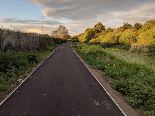
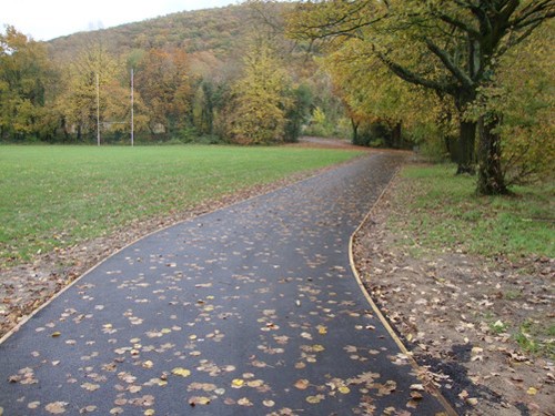
Route development
We are striving to make it safer and easier for people to walk, cycle and wheel in and around the county through improving walking and cycling routes and facilities for everyday journeys. This section details the active travel schemes that we’ve developed in recent years through Welsh Government Active Travel Funding.
Improvements to routes
The Council makes byelaws to help manage public open spaces so they are safe, welcoming and well cared for.
The byelaw for the Gnoll Grounds and War Memorial Gardens explain how these areas can be used. They help protect their historic and commemorative importance and support safe shared use by residents and visitors.
These rules may be reviewed and updated to reflect changes in law, policy or local needs. Full details of the Second Written Statement are available in the Gnoll Grounds and War Memorial Gardens documents.
Scheme development overview
We are working to improve roads and public spaces in the Sandfields area so that walking, cycling, and wheeling become safer, easier, and more attractive options for everyday journeys.
Progress so far
Feasibility and early design (2022–23)
A study identified 10 routes across Sandfields for potential upgrades. These ranged from small-scale improvements such as dropped kerbs and tactile paving (to support visually impaired users), to larger interventions including new cycle lanes and pedestrian crossings.
Public engagement and next stage (preliminary) design (2023–24)
In early 2024, we carried out stakeholder and public engagement to gather views on the proposed upgrades. Following this, a business case and first designs were prepared for the top three priority routes:
- Seaway Parade, Handel Avenue, Purcell Avenue and Scarlet Avenue
- Princess Margaret Way
- Victoria Road and St Paul’s Road
Finalising the designs - detailed design (2024–26)
Work progressed to finalise designs for these three priority routes, so they are ready to be constructed.
Placemaking and public realm expansion (2025–26)
The scope of the project was expanded to include placemaking and public realm improvements, aligned with the wider Aberavon Seafront Masterplan. This includes greening, play features, and enhancements in four key areas:
- around Memo Beach Café
- next to the skatepark (off the promenade)
- approach to Tywyn Primary School (off Victoria Road)
- green area on Purcell Avenue
Two public drop-in sessions were held in September and October 2025 to capture feedback on initial ideas. Designs are now being developed, with completion expected in early 2026. This public engagement exercise is now closed. We will publish a summary of your feedback in due course. Thank you for participating.
Delivery of minor works (2025–26)
In the meantime, early physical improvements are being delivered, including:
- missing dropped kerbs and tactile paving on key walking routes
- new cycle storage facilities
- a zebra crossing installation
Construction phase (2026–27 onwards)
We are in the process of applying for funding through the Regional Transport Fund to begin construction. If funding is received next year, works are expected to continue into 2027–28.
Further details on construction timeframes will be shared in due course.
Key documents
Sandfields Active Travel Masterplan: Public Engagement Report (2024).
We’re excited to share that Phase 1 of the Neath to Cimla Active Travel Project is officially underway.The contract has been awarded to GD Harries & Sons Ltd , with construction starting on 13th October 2025.
This phase will deliver a walking and cycling route connecting Neath Town Centre, beginning at Forster Road, passing through Gnoll Country Park, and continuing to Afan Valley Road (B4287) alongside Crynallt Primary School. These improvements will make walking, cycling, and wheeling safer and more convenient—helping residents choose Active Travel as their preferred way to get to work, school, or the shops.
Phase 1 includes:
- widening footpaths for shared use, allowing people to walk and cycle safely side by side
- installing raised plateaus at key junctions to support safer crossings for those with reduced mobility
- creating new sections of shared use path to improve route continuity
Works are expected to be completed in early 2026, with Phase 2 to follow. We’ll keep you posted throughout with regular updates.
This project is funded by the Welsh Government’s Active Travel Fund grant award, which means it can only be spent on walking, wheeling, and cycling improvements.
A consultation took place between September and October 2024. We asked residents their opinions on the proposed upgrades. See the proposals and the results of the consultation.
The Neath Town Centre Masterplan is aimed at transforming how people move through Neath Town Centre. The project seeks to enhance walking, wheeling, and cycling infrastructure to create a safer, more accessible, and environmentally sustainable town centre. The council is focusing on three specific routes being further developed this year:
- Route 1: Neath Abbey Road, Cadoxton Road, and Bridge Street
- Route 2: Cadoxton Road, B4434, Riverside Road, and Prince of Wales Drive
- Route 3: A section of Gnoll Park Road
Possible improvements include small-scale enhancements like dropped kerbs and tactile paving, as well as bolder changes like creating shared-use paths and introducing new safe crossing facilities for all users.
With these introductions, Neath will become a more connected and inclusive place for all residents and visitors.
A report has been produced summarising the feedback received from stakeholders and the public during the concept design and explaining how the comments will be considered in the future.
The initial public consultation for the Neath Town Centre Masterplan took place from 10 March to 7 April 2025. We appreciate all the feedback received during this period.
The walking and cycling route alongside Fabian Way and Ffordd Amazon is a key route for people commuting to Swansea from Neath Port Talbot and vice versa. Minor improvements (for example, improving drainage, cycle signage and road markings) were undertaken on this active travel route to make it easier for users to navigate and to bring it up to Active Travel (Wales) Act 2013 standards.
This popular link between Dwr Y Felin Comprehensive and Neath Town Centre received active travel funding in 2020 to improve the footway between the existing footbridge and Neath town centre. Works included resurfacing and the installation of dropped crossings/tactile paving to allow better access for all types of users.
Largely along the Neath Canal, this picturesque route received active travel funding over a four-year period. Improvements undertaken in this timeframe include resurfacing, barrier removal, improving signage and installation of a speed reduction crossing on the B4434 between Briton Ferry and Tonna. These upgrades have enabled members of the community such as those with prams, wheelchairs or mobility scooters to travel between the residential areas of Briton Ferry and Tonna to the shops in Neath easier and with less restrictions. It has also encouraged more people to use the route.
Before and after photos
Neath Canal before the improvement work

Neath Canal after the improvement work
Following a mixture of riverside paths, new purpose build sections and old railway lines, national cycle route 43 provides an important walking and cycling link from Pontardawe to Swansea and Ystalyfera on almost entirely traffic free paths.
Improvements to this route were largely from Pontardawe town centre to the Swansea boundary, it involved upgrades to surfacing, (including providing a tarmac path around the edge of Pontardawe Recreation Ground) and removal of cycle barriers. This has provided better access for all users including disabled people.
Before and after photos
Pontardawe cycle route before the improvement work
Pontardawe cycle route after the improvement work
This scheme involved construction of a small section of route between the National Cycle Network and Godre'r Graig. Works included obtaining landowner permission to undertake the works, resurfacing the route, raising the parapets (safety barrier) on the footbridge, barrier removal and drainage improvements. This has provided a safe walking route linking Godre'r Graig to the rest of National Cycle Route 43 and beyond.
The villages of Blaengwrach and Cwmgwrach are separated from Glynneath by the A465. The only safe pedestrian route providing a link from these communities to Glynneath is through an underpass under the A465 and across a footbridge over the river Neath. The footbridge over the river Neath has been replaced by Neath Port Talbot following irreparable damage to the previous bridge during storm Dennis. The new footbridge was constructed with greater width to allow the construction of a shared use path. Active Travel funding was used to widen the existing footways from the newly constructed health centre to the new footbridge. This improved accessibility for all including wheelchair users and cyclists.
Improvements have been made to active travel routes: FR-PT-SU065 and FR-PT-SU064 on Southdown Road and Southdown Court to improve walking and cycling links between Baglan Bay Retail Park and Sandfields housing estate. Works included:
- widening and resurfacing of path to enable shared-use of the path
- improvements to junctions including adding tactile crossing points throughout
- improvements to lighting near the bridge access

Significant enhancements have been made to strengthen the connection between Tonna Hospital and the surrounding community. These efforts have focused on improving access to local shops and public transport, supporting residents’ Active Travel needs.
The completed work includes:
- widening existing footways
- improvements to the crossing facilities at junctions. These include a raised roundabout and numerous dropped kerbs with tactile paving through the village
- reduction in speed along the route from 30mph to 20mph and the introduction of a transition zone between the 20mph section and 60mph section
- relocation of the bus stop to allow the improvement of the side road junction
- installation of seating on the route
- installation of a green wall to enhance biodiversity and the local environment
Before and after photographs
Tonna Uchaf junction to Pen-Y-Byn, Tonna


Bus-stop on Tonna Uchaf, Tonna


Raised roundabout


The introduction of a toucan crossing will help reduce vehicle speeds and alongside new parking restrictions on Village Road, will ensure safer crossing for all users. These measures enhance connectivity between the local residential area and key destinations such as Ysgol Bae Baglan and National Cycle Route 4.
Before and after photographs
Village Road, Baglan. The new toucan crossing is a type of signal-controlled pedestrian crossing that allows both pedestrians and cyclists to cross the road at the same time.


Improvement to facilities
An access barrier is anything that restricts or prevents any users from accessing or travelling along walking and cycling paths.
Access barriers have historically been installed to stop motorbikes and mopeds from using paths illegally however they also prevent legitimate users (such as those with mobility aids or non-standard cycles) from walking, wheeling or cycling along the network. Barriers also affect people who are not able to get off their cycle to manoeuvre through or around them.
Since 2019 we have removed or replaced 59 non-compliant barriers, opening up access to our network of routes for all users. Funding will be used to build on works undertaken in previous years to replace non-compliant barriers and make our routes more accessible.
| Financial year | Number of barriers replaced with compliant bollards |
|---|---|
| 2019-2020 | 14 |
| 2020-2021 | 11 |
| 2021-2022 | 18 |
| 2022-2023 | 9 |
| 2023-2024 | 4 |
| 2024-2025 | 4 |
View a map of our barrier improvements under "Complaint barriers" and "Removed barriers"
If there are any other barriers you would like to see removed, please get in touch at greener@npt.gov.uk. We will assess the feasibility of altering these barriers.
Have you seen a motorbike or moped using Neath Port Talbot’s cycle paths illegally? If the answer is yes, then report it to South Wales Police.
A bike can be costly and leaving it unattended makes it prone to theft or vandalism. Bike racks can help to provide a secure place for cycles while the rider is at their workplace, the shops or school. Installing cycle shelters could also encourage people to use bicycles as a means of transport. We have installed three cycle shelters in 2022/2023 in:
- Aberavon Shopping Centre
- Aberavon Beach
- Port Talbot Train Station.
Cycle hoops also have been installed in Cymmer near to the Refreshment Rooms, to replace cycle storage which had fallen into disrepair.

Free cycle stands
To help encourage more people to cycle, we are giving away up to four free cycle stands to organisations in locations where cycle parking is needed. More details and apply.
Securing your bike
Tips for locking your bike
- Use two bike locks when possible
- Always lock both the wheel and the frame together
- Never only lock the wheel or the frame of the bike to the stand

BikeRegister
In 2021 there were over 64,000 reported bike thefts in the UK. Having your bike stolen can be a huge inconvenience and very upsetting. But registering your bike means that if it's ever stolen and recovered by the police, it can be traced back to you. The BikeRegister is the UK’s national registration scheme. It's free, and it's preferred by the police as a way of registering your cycle.
Seating along walking and cycling routes can provide a much-needed place to rest. Outside of town centres there are generally fewer places to sit and have a break for those travelling between their homes and key destinations. So, we have started installing new seating alongside cycle routes in the county borough. In 2021-2022 eight new seats were installed. In 2022, a stakeholder consultation was undertaken to determine where additional seating is required. Proposed locations were evaluated, and seating was installed at three locations.
If there are any walking and cycling routes that you think need some seating, get in touch at greener@npt.gov.uk. We will assess the suitability.
Cycle storage and access barrier locations
See the cycle storage and cycle barrier locations we have mapped out:
This is not an exhaustive list. Email activetravel@npt.gov.uk to tell us about any you notice are missing.